
For helicopter onshore operations at known landing sites, an accurate survey can de-risk operations and can be distilled down for the crew to use into a Company Landings Site Directory (CLSD). Various levels of scrutiny can be applied, with more rigorous surveys giving fewer restrictions than just an estimation taken by a customer.
The survey needs to consider the aircraft types which are going to be used at the sites and how their respective flight profiles fit in with the obstacle environment around the site. In this article, we are going to highlight the rules that surround site surveys and the necessary procedures which need to be in place to catch hazards before they catch out crews on task.
This blog builds on our obstacles in the backup area article and the blog on helicopter landing site markings. It is not about HEMS operating sites that are assessed from the air during a mission – look at our other article on 2D or not 2D which covers that topic. This article focusses on the UK regulations, but the principles apply to any helicopter operation.
Regulations
In the UK, the regulations for off airfield landing sites starts in the UK Air Operations Regulation. In AMC1 CAT.OP.MPA.105 and AMC1 SPO.OP.100, CAT and SPO operators are directed to ensure operating sites are adequate with due consideration of the performance requirements. The CAT rules also specify that reference is made to the guidance in ICAO Annex 14 Vol II and ICAO Doc 9261 Heliport Manual. For NCC and NCO operations the requirements are more relaxed.
The CAA published further guidance material on the requirements for off airfield landing sites in CAP 3043 in October 2024. This guidance builds on the AMC filling in many of the gaps in the regulations. In particular, guidance is provided regarding lighting of sites at night. More extensive guidance is also published for the design of hospital landing sites in CAP 1264 but the guidance for operator surveys of hospitals is still found in CAP 3043.
The British Helicopter Association (BHA) as provide some guidance here for unlicensed landing sites.
What is adequate?
In determining the adequacy of a site, the AMC provides a list of characteristics which need to be considered:
- Site dimensions
- Location and height of obstacles relevant to arrival and departure
- The approach and departure paths chosen
- Surface conditions (eg sand/snow)
- Helicopter types authorised to use the pad
- Control of 3rd party access
- Activation procedures
- Communications facilities
- Lighting for night operations
Although not mentioned in the AMC, several other elements need to be considered for adequacy:
- Access to the site for the intended purpose (eg meeting passengers in ground vehicles)
- Emergency equipment availability
Site dimensions
The regulated minimum size for a site appears in the Cat A section of the Rotorcraft Flight Manual. So for an EC135 with a D value for 12.16m, the minimum size of a landing site is 15 x 15m or 20m diameter. Guidance in ICAO directs a minimum size for the Final Approach and Take Off Area (FATO) of 1.5 D so the EC135 Rotorcraft Flight Manual exceeds this requirement.
Additionally, ICAO guidance adds a minimum extra 0.25D or 3m safety area around the landing site. This brings the total minimum area to 2D (this coincidentally is the minimum requirement for a HEMS site – see here). However, this is very much the minimum requirement for a site. It does not consider the performance requirement mentioned in the AMC.
Typical helicopter’s Category A profiles for helipads are backup procedures. This means obstacles behind the helipad have to be considered carefully. Obstacles are addressed separately, but often there is a requirement for a flat area back from the helipad. The most restrictive light twin helicopter in this respect is the AW109, which needs a full 40 m of flat area from the centre of the helipad in the backup area. Some aircraft of course need no backup area due to pure vertical departures (eg H145).
This gives us a basic dimension requirement of 2D (normally as a 2D x 2D square) with sufficient space in the backup direction for the backup procedure. However, this does not cover the downwash and outwash the helicopter generates. It may be necessary to select a larger site to avoid damage to surrounding infrastructure or people.
If a profile other than a helipad or vertical-type is chosen, the minimum size of the take off area can rapidly get bigger. For example, the short field VTOL2 take off on an EC135 requires a 75 x 15 m take off area plus a significant area of obstacle free surface in the take off direction (over 200 m). A site surveyor needs to understand what types of profile are possible so they can provide a useful survey.
So, assuming a helipad type profile, dimensions not less than 2D x 2D plus backup area for each take off direction plus extra for downwash. But basically, bigger is better.
Obstacles
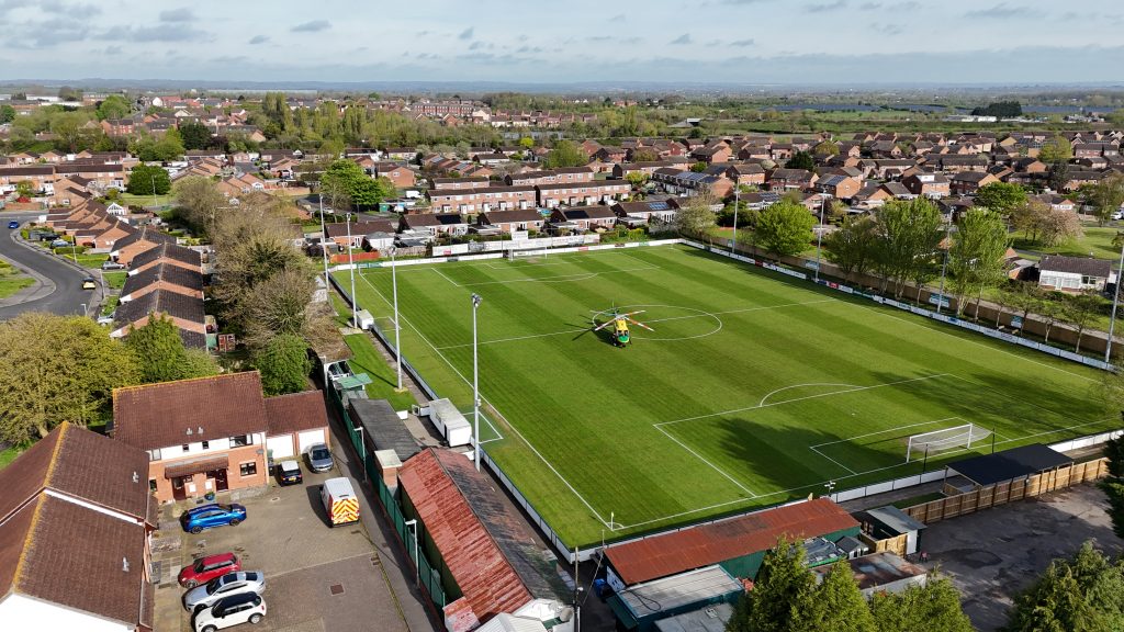
As already mentioned above, the obstacles around a site and their distance relative to the FATO are critical in choosing a landing site. All relevant ones need to be recorded. It may be possible at an elevated site to consider take off and approaches in any sector, but it is more likely that nearby obstacles or prevailing wind will narrow down the options (and reduce the surveyor’s workload). The relevance of obstacles is linked strongly to the position chosen for the actual FATO (eg choosing the centre of the football pitch above gives more options).
The helicopter does not need to parked in the FATO though. The Touchdown and Lift Off (TLOF) point is used for that purpose and may be separate from the FATO. This may be done to allow multiple helicopters to use the site but as the aircraft makes less outwash when in the ground cushion, having a separate TLOF can allow closer operations to sensitive ground areas.
Two aspects need to be considered with respect to obstacles: the departure and the backup area (if non-vertical arrivals or departures are being considered).
Departure
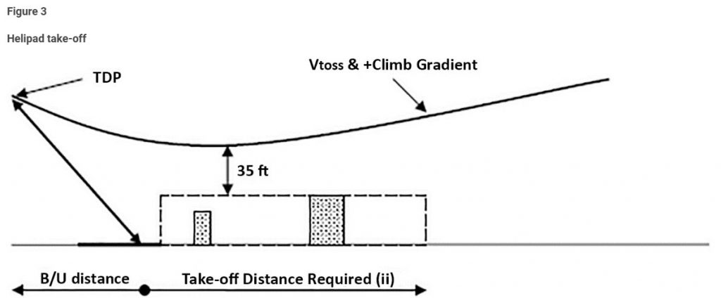
For the departure, the helipad surveyor needs to consider the case of a helicopter which has lost its engine at TDP and is continuing with the departure. The take off path includes an acceleration phase using emergency power (eg 30 sec rating) where height dips as speed is gained followed by an initial climb at VTOSS at contingency power (eg 2.5 min rating or 2 min rating), followed by a climb at Maximum Continuous Power (MCP) from 200 ft or when the contingency power times out. For this entire profile, obstacles in the take off path need to be considered. This can be a considerable distance (several kilometres).
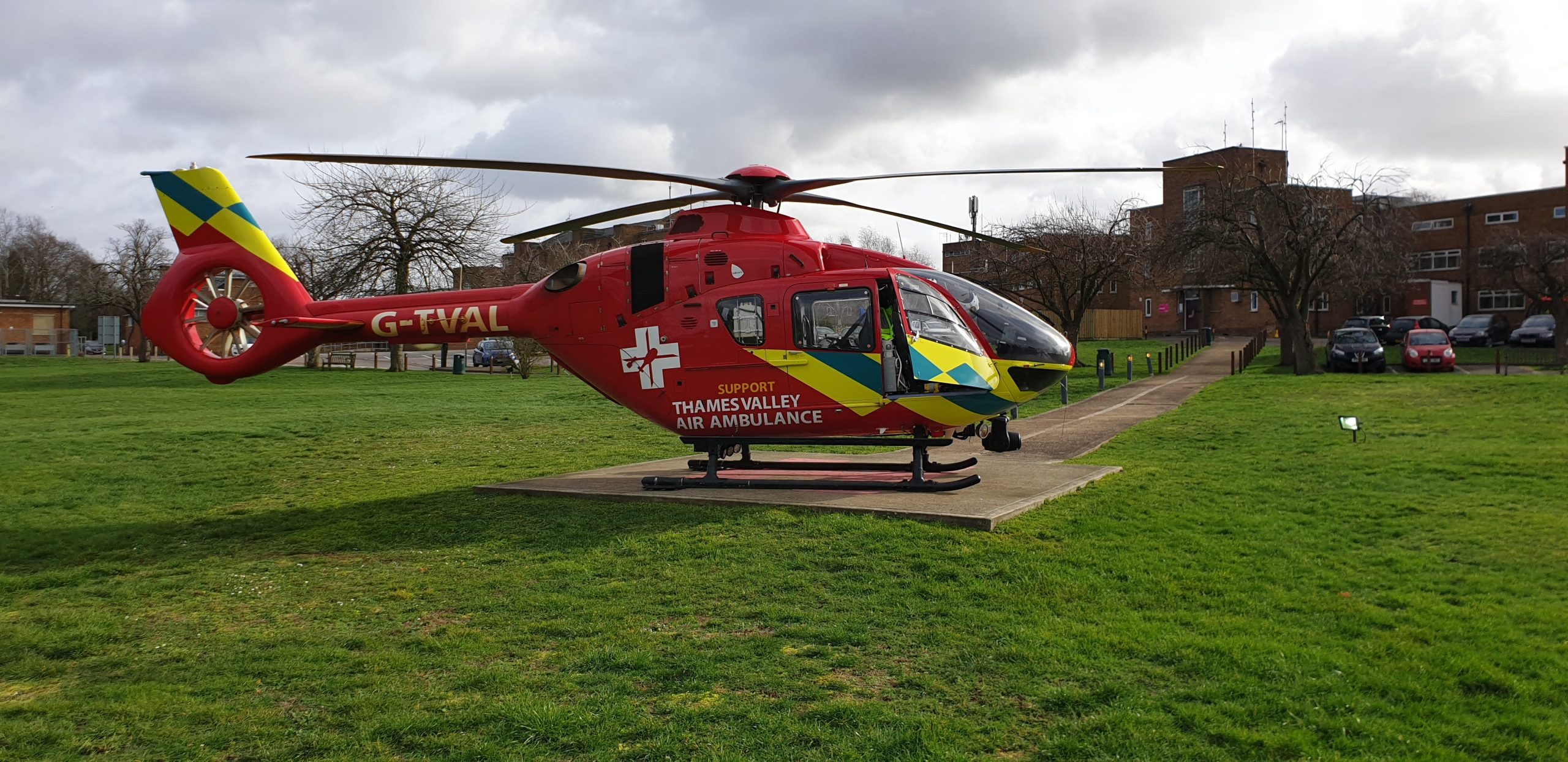
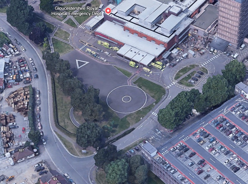
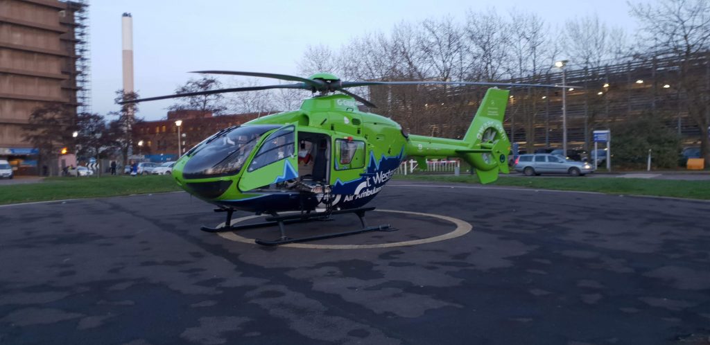
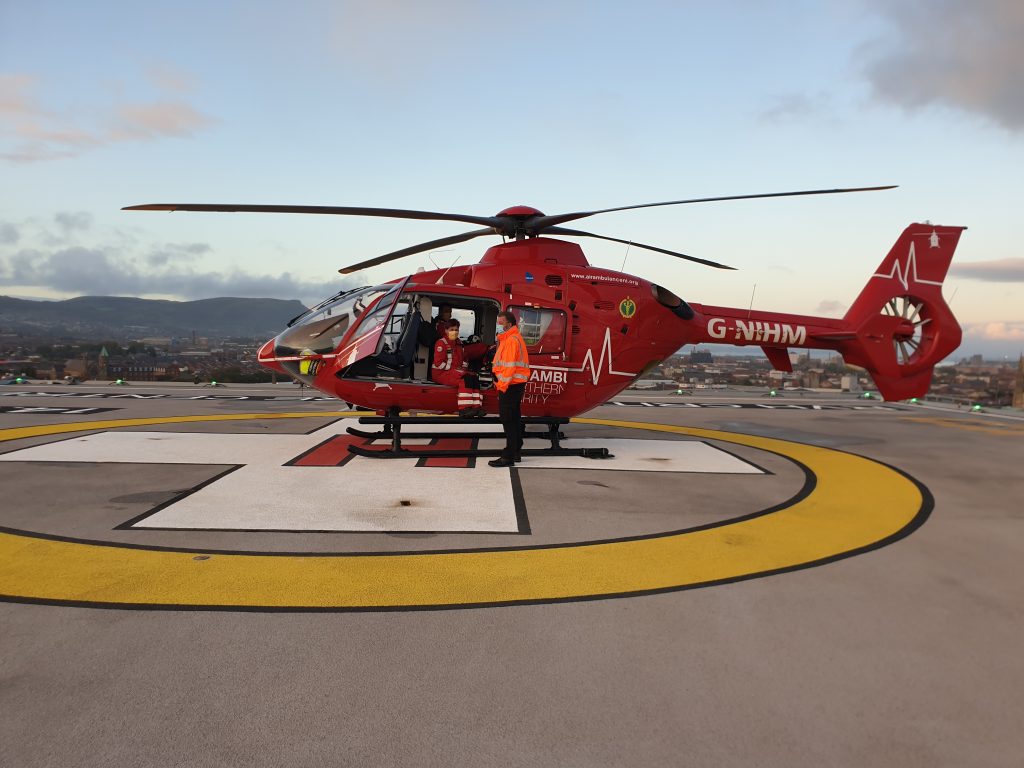
However, at many landing sites, it’s reasonable to look at the obstacles that can be seen from around the landing site, as more distant obstacles can usually be avoided with small permitted turns. This may not be the case in terrain where rising ground or ridgelines need careful consideration. For example below, the car park behind the helicopter and the hospital building to the left definitely need consideration. The chimney being close to the landing site needs to be considered but it could probably be ignored if it were further out due to the possibility to turn.
The surveyor needs to record several things for relevant obstacles:
- The description of the obstacle
- Its distance from the FATO
- Its height relative to the FATO surface
- The relative direction or arc of the obstacle around the site (eg the car park above might be relevant from 150 to 200 degrees relative to the FATO).
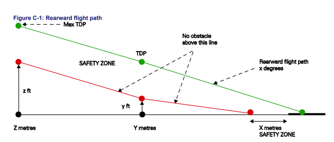
Backup area/Approach
The same consideration of obstacles is needed for the approach. In most cases, the requirements are more rigid than the departure phase and it is very rare to be able to adjust the approach or take off if conflicting obstacles are present. However, the actual consideration of the obstacle in terms of height and distance from the FATO are just as relevant.
It is important to remember that the approach and departure paths might not be exact opposites of each other and so different sets of obstacles for each element need to be considered.
Adequate obstacles?
With the obstacles now assessed, what is adequate for this aspect of a site survey? It heavily depends on the aircraft type(s) being considered which makes it critical that the surveyor understands the aircraft types performance characteristics. A site suitable for an AW169 might not be suitable for an AW109 despite the former’s larger size and mass.
The surveyor must receive adequate training on the relevant aircraft’s performance. This is especially important if the surveyor is not qualified on all the proposed types for the site or is not a qualified pilot. In any case, the obstacles are adequate if they allow the aircraft to make an approach and departure without the obstacle penetrating a required clearance plane. The measurement of obstacles is covered later.
Approach and Departure Paths
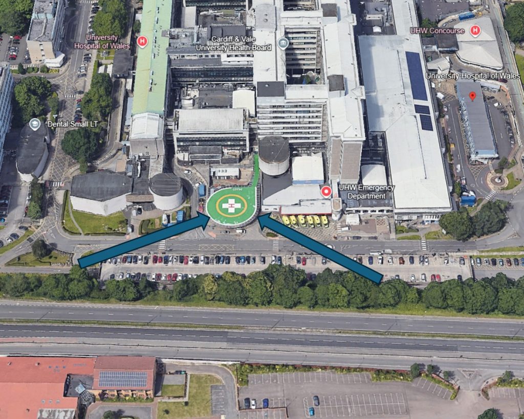
As already mentioned, it may be possible at some sites to allow approaches from any direction if the site is open or elevated. However, it is likely that several defined paths have to be chosen. Ideally two approach paths split by 180 degrees should be chosen to cover every possible wind direction, but a minimum 135 degrees separation is recommended. Any separation less than 180 degrees increases the risk that an approach is impossible due to a downwind component (downwind approaches or departures are prohibited in Category A profiles). As an example, Cardiff Hospital’s pad has approach paths that are split by less than 180 degrees making approaches with a wind from due south impossible.
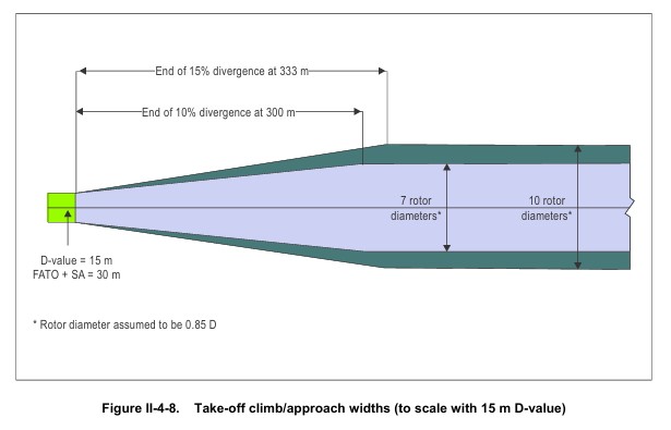
Having selected approach paths, the obstacles need to be assessed against those approach paths and a suitable buffer area around each option. The width of the FATO plus an increasing area with distance needs to be considered. The divergence is 10% by day and 15% by night. This continues until 7D or 10D respectively as shown below.
Practically, its normal to consider the relevant obstacles in visual range of the site. It is crucial to record the considered approach and departure directions as part of the survey to prevent later assumptions leading to a normalisation of deviance by frontline crews.
Surface Conditions
The surface of a landing site can be strongly affected by downwash. Any loose surface has the potential to damage nearby infrastructure or hurt people (gravel is a really bad idea!). In addition a loose surface might lift and restrict vision. The worst kind of dust is usually the kind created by a fleet of trucks moving over an area of dirt – such a site is likely to be inadequate. Snow may cause issues, but is hard to predict the effects if not present during a site survey.
The load bearing properties of a site also need to be considered. A site with a grass surface may be ideal in summer but it is well worth investigating during a survey whether it is prone to flooding and/or muddy conditions.
Helicopter Types
The helicopter types using the site will heavily influence whether other aspects are adequate. As already highlighted, it is vital that site surveyors understand the aircraft that are using the site. A survey by one operator for a particular type does not mean that survey is “portable” to any other operator using different machines.
The aspects of a helicopter which affect the adequacy of a site include:
- The size of helicopter
- The mass of the helicopter
- The landing gear configuration (skids vs wheels, surface pressure, dimensions etc)
- The performance characteristics, particularly take off and landing profiles
- The downwash and outwash
- The sloping ground capability of the aircraft
Again, the surveyor needs a clear understanding of the relevant aircraft types intended for the site.
Control of 3rd party access
At some sites, control of access is easy – the most secure being an elevated helipad on top of a building. However, helicopters often operate to much more open common land. The ability of 3rd parties to access the site needs to be assessed and the adequacy of contingency measures addressed.
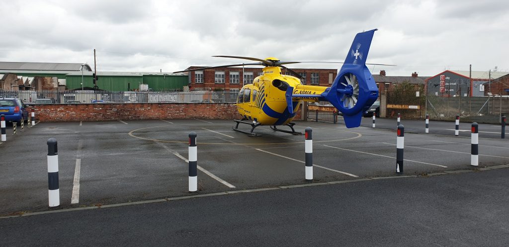
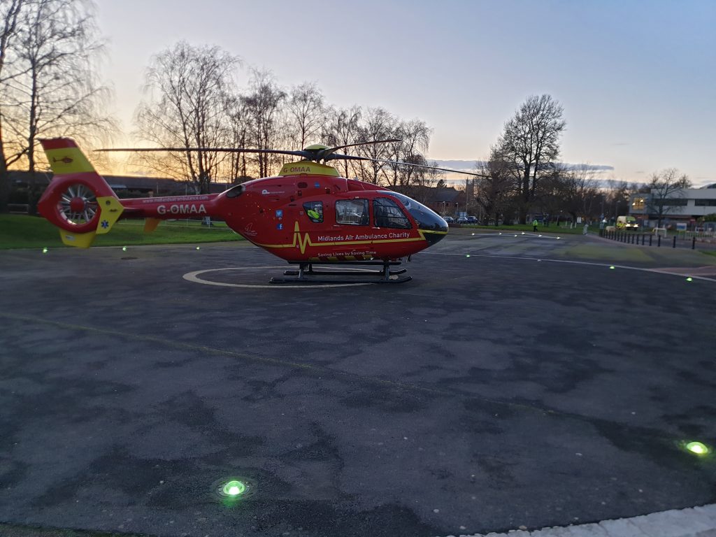
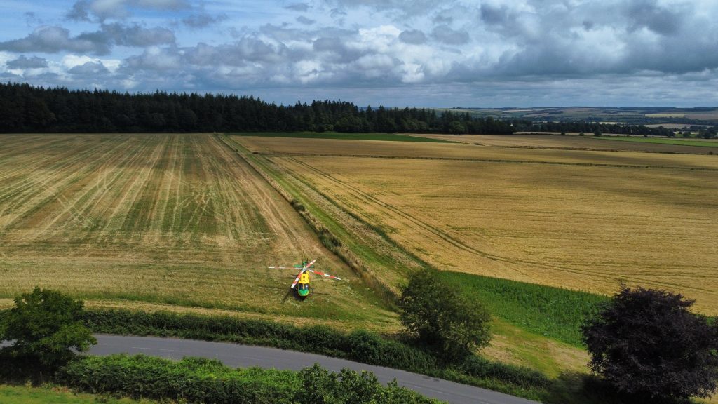
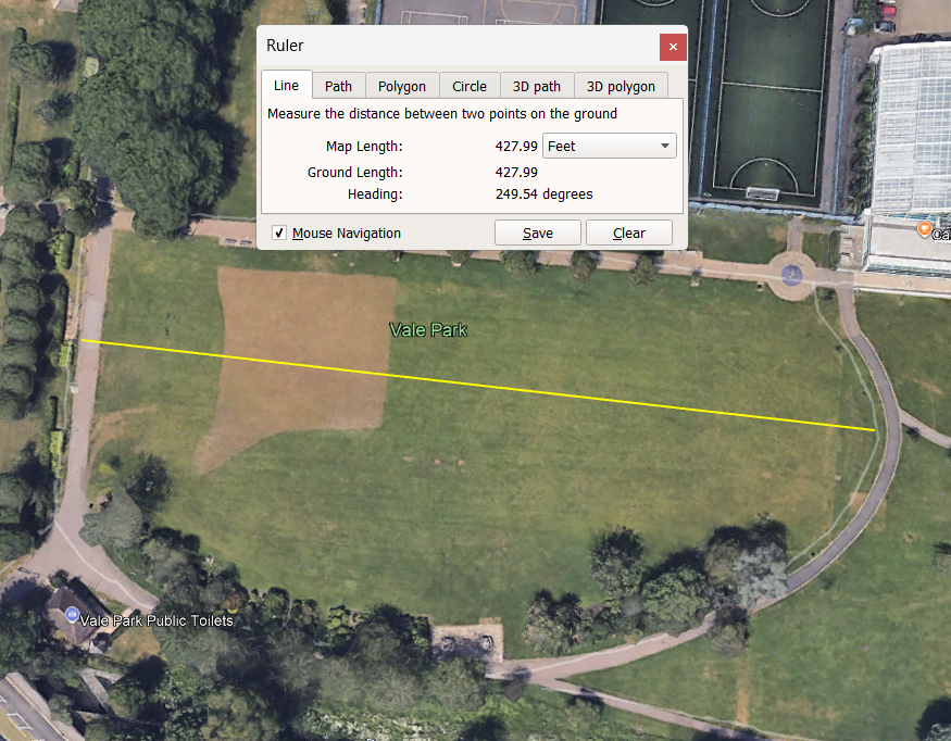
For example, a company landing site might be chosen on completely public ground such as a park. This is highly likely to be accessible by the public during any potential approach and departure. In every use, the pilot needs to assess the risk before any approach or departure but the site surveyor can greatly assist this process by identifying any particular risks. For example, there might be only one way into an area which may guide the crew to keep an eye on that area during an approach or, as shown below, there may be open access all around. This may need mitigation (eg security) to be deemed adequate.
Activation procedures
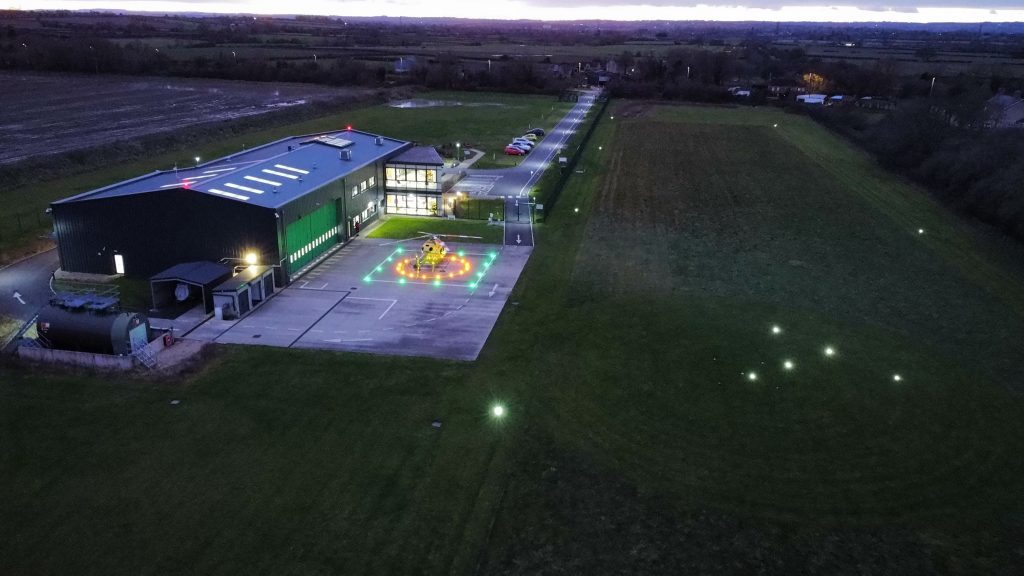
If security is required as a mitigation to open access, activation of a helipad may be needed. This needs to included when considering the adequacy of a site. The availability and lead time for any activation also needs to be established. This is particularly true for night operations when considerable time may be needed to place lighting or secure a site in the dark. As discussed in my helipad lighting article, there needs to be a clear indication, visible from the air, that a site is “ready” for a helicopter. The helipad lights being “on” is not adequate – they are normally invisible by day and are sometimes pilot controlled with obvious issues!
Communications facilities
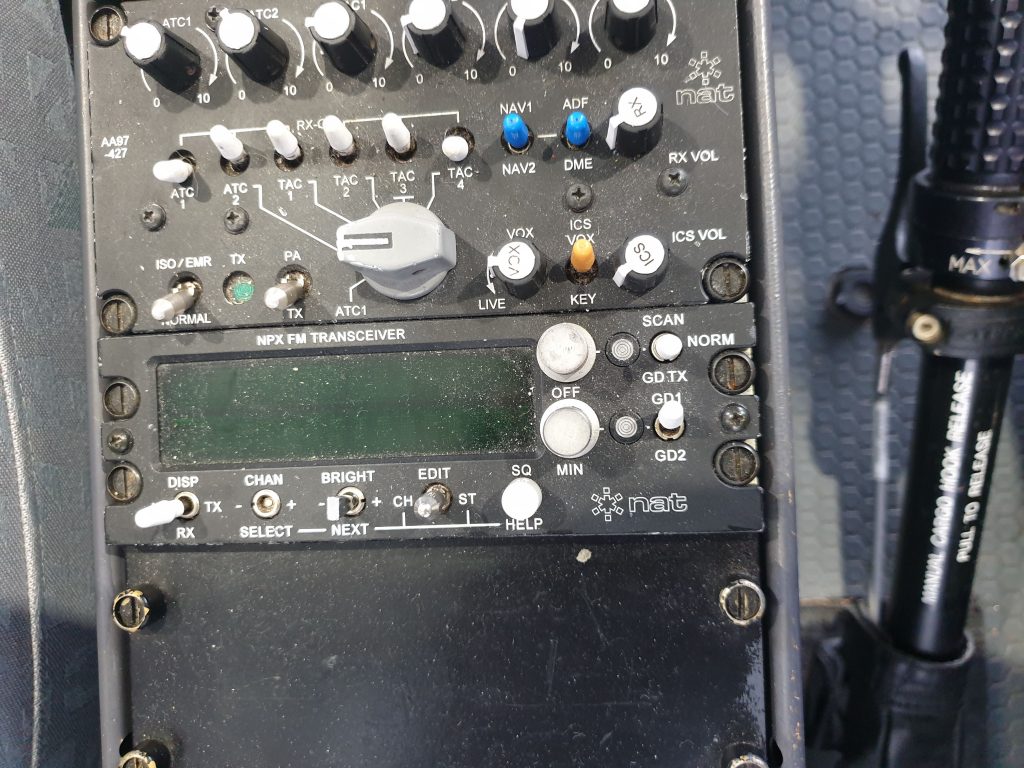
The adequacy of communications may be highly critical for landing sites with multiple FATOs or helicopter stands. A dedicated ground radio operator may be available, but otherwise a common “helipad” frequency may be designated. Any standing arrangements need to be covered. It is also worth checking the expected helicopter types have the capability to use the communication method – some helipads in the UK have used Marine Band radios in the past as a helipad frequency. Not very helpful if you do not have that in the aircraft or do not know how it works.
Lighting for night operations
The adequacy of lighting for night operations to onshore helipads, is strangely poorly defined in the UK regulations. At the most basic level, the lighting requirement is simply described as needing to be “adequate”. However, CAP 3043 expands slightly on this by referring to the ANO at Article 210. This article refers to Public Transport operations which is actually only relevant to aircraft not subject to the Basic Regulation (eg state aircraft such as the Police and Coastguard). However, the CAA strongly recommend through the CAP, that all operators follow this guidance. The guidance is not very descriptive:
The guidance can be summarised below (with our emphasis):
The site operator must ensure that sufficient lighting is provided to:
- Identify the landing area in flight
- Determine the landing direction
- Make safe approach and landing
- Make safe take off
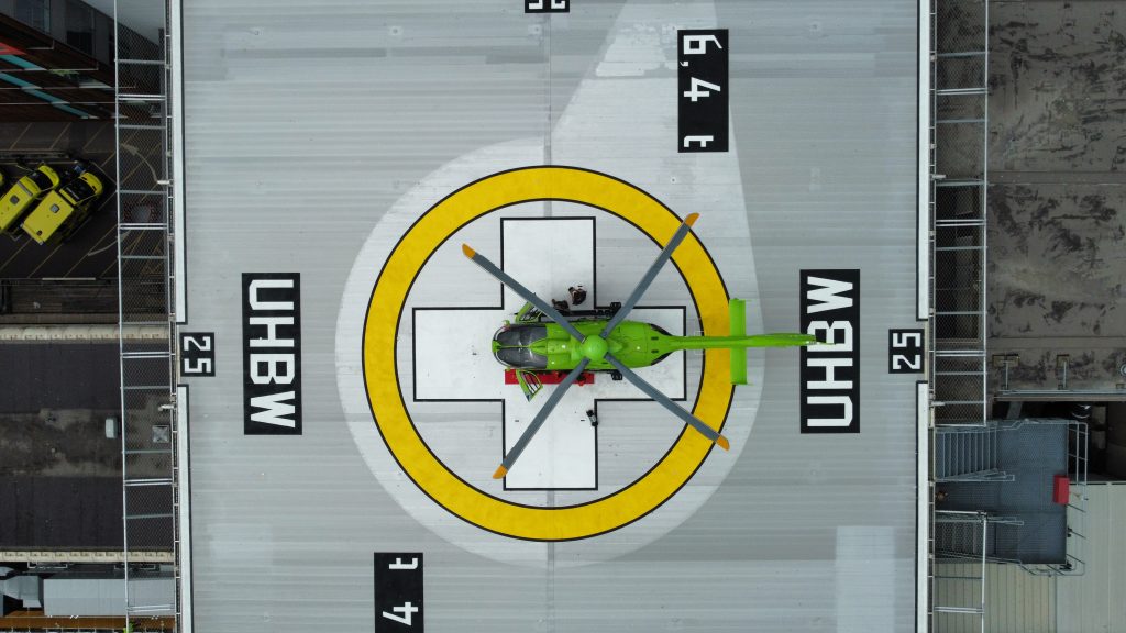
The military have a quite efficient method for achieving this using a NATO “T” as shown below. The direction is indicated by approaching from the base of the T towards the cross bar. The “safe” area is either side of the T stem. Other light configurations may be possible but the direction must still be possible to discern – a circle of lights is unlikely to be adequate. A NATO “Y” is also possible but less common.
Access
Helicopters generally do not just land for fun and there is a purpose in mind. The accessibility of the site for that purpose needs to be assessed. For example, if the purpose of the site is to meet passengers or cargo, the availability of hard surface access and the need to control traffic must be assessed for adequacy. The environmental conditions may dictate a site is only suitable at certain times of the year or in certain conditions.
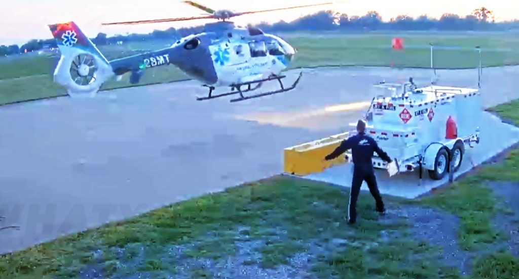
Emergency equipment
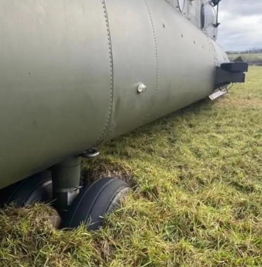
Dependent on the needs of the operation, appropriate fire extinguishers may be needed (eg on an elevated helipad). These need to be assessed for adequacy by surveyors. It is vital to ensure that the covers on any fire extinguishers are secure – a loose cover destroyed the fenestron on an EC135 in the USA. The cover is the red blur in the right of the image below.
Adequacy Summary
Assessing the adequacy of a landing site is a skilled task. It requires a trained person (see more on the skills required below) with adequate tools and knowledge of helicopter operations of the specific types required.
Surveyor Training and Equipment
A surveyor needs knowledge, skills and equipment to achieve their task.
Knowledge
A site surveyor needs to understand helicopter operations to be effective in their role. They do not need to be a helicopter pilot but they need a similar level of knowledge about helicopter performance. This must be based on the expected helicopter types and the characteristics mentioned earlier.
A surveyor must also be familiar with how information about the site is recorded in CLSD such that all the necessary information is captured.
Skills and equipment
The main skill for a site surveyor is the ability to measure obstacles in terms of there relative direction, distance and elevation. The various elements require equipment to capture the data:
- Direction – a compass is the most ideal equipment. Phone or watch based compasses may be useful but must be carefully calibrated as they are notoriously unreliable – when they are used a gross error check must be performed. Bearing data is vital so a traditional compass should be used whenever possible, preferably with a mirror so it can be used a sighting compass.
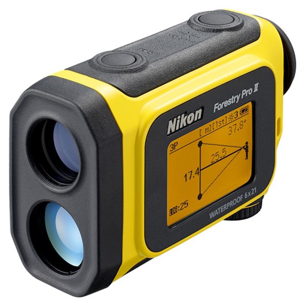
- Distance – a laser rangefinder with a sighting optic is essential equipment. A good stabilisation system makes accurate sighting easier but can inflate the costs considerably. Use of online mapping may be permitted for some survey types (measured sites – see later), but CAP 3043 implies that it is not sufficient for a full site survey. Information from the site operator may be sufficient for lowest level of survey (estimated). For example: “It’s a football pitch surrounded by seating 20 ft high”. However, this level of survey may restrict operations (eg no night operations – see later)
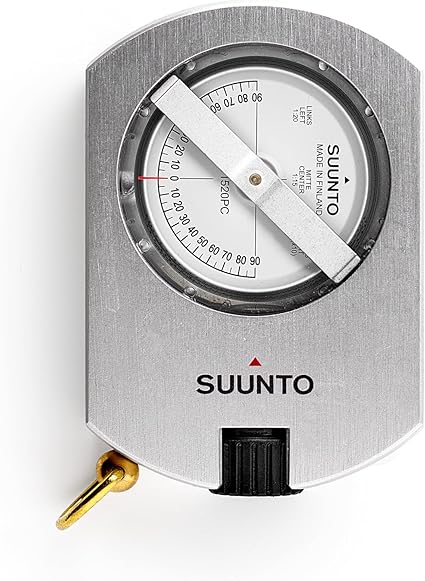
- Elevation – the elevation of obstacle can be determined with an inclinometer. This can be a mechanical device, an integral part of a laser rangefinder or a phone app. The angle measuring capability of a phone is much more reliable than the compass function and may be sufficient. The “gold standard” is the combined rangefinder and inclinometer. A protractor and a piece of string may be enough.
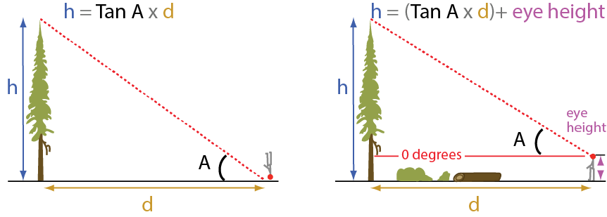
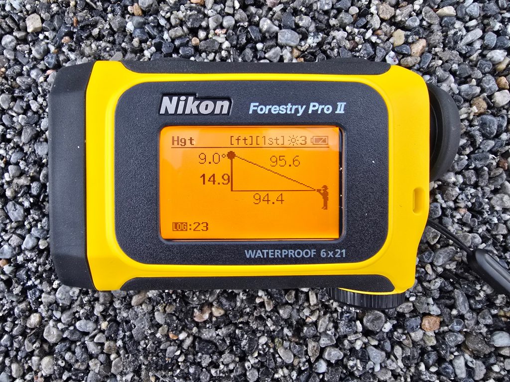
In any case, it is vital that a surveyor is trained to use the equipment effectively and has adequate capability to record the data in a usable form. Any training requirements need to documented in the company operations manual. This should include the necessary maths skills needed to convert the data from the equipment to usable elevation data as shown below, if it is not automatically done via the laser rangefinder.
Training Records
Surveys may be completed by an external agency but in all cases the training of site surveyors needs to be documented and they must have recurrent training annually. All line pilots should be trained to complete measured and estimated site surveys (and may also be trained for surveyed sites).
Types of site survey
Estimated
An estimated site is when no reliable data is available but a reasonable estimate of the site size and obstacles has been received. A minimum acceptable size should be specified in the operations manual for each type/approach option.
Even though the site is estimated, a Landing Site chart should still be produced but must be marked as “Estimated”. On arrival the pilot in command should verify the site dimensions and confirm the obstacle environment is satisfactory.
Estimated sites can be used by day only in non-congested areas. No performance credit for wind is permitted and no downwind component is allowed.
Confusingly CAP 3043 mentions later in paragraph 3.8 that an estimated site in a congested area can be used for take off provided it is measured or surveyed before the departure occurs (with the aircraft shutdown). It is not clear how the aircraft can land in the first place!
Measured
A measured site is one which has been measured but not to the extent required for a surveyed site due to being a “virtual” survey using online tools. This includes the use of satellite imagery from online mapping. Vertical extent of objects is completed through using “known” objects – eg a typical 2 storey house is around 25 ft tall.
A landing site chart is needed and should be marked as measured. No performance credit for wind is allowed.
Measured sites may be used for day operations only. If the site is smaller than expected on landing, it should be re-measured or surveyed prior to depature.
Surveyed
A surveyed site which has been accurately measured (the guidance implies it is done in person) and may be used by day and by night with adequate illumination.
Surveys are valid for a maximum of 12 months before needing to be re-surveyed. This may be done by operating crews during a visit, but it is implied that this would have to be done while shut down by a trained person. Simply flying into a site or just being a trained pilot is not sufficient. The survey should be recorded on Landing Site chart which should include the expiry date.

Recording helicopter landing site data
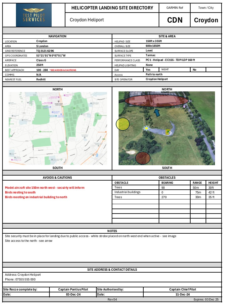
An effective landing site chart should include all the pilot needs to know in a consistent, easy to read format. In particular, it needs to be easy to read in a digital format on an EFB screen as this will be where most crews will be accessing the data in current operations. This implies black text on a white background but other colour combinations may work. For CAT/SPO operations, the landing site data should be in the Operations Manual. This is usually in the form of a Company Landing Site Directory (CLSD) referenced from Part C of the Operations Manual. This may be embedded in an EFB app such that crews can access the geo-referenced data from the map.
CAP 3043 provides the following further guidance for contents:
- Diagram and/or an aerial photograph
- Dimensions
- Location and height of relevant obstacles
- Approach and take off paths (or sectors)
- Surface conditions
- Site suitability with reference to aircraft performance (eg which Cat A profile)
- Provisions for control of 3rd parties (if applicable)
- Procedure for activating the site
- Communications (if applicable)
- Lighting (if applicable)
The following addition data is also recommended:
- Location data – Location data in the exact format used in the aircraft navigation system should be provided along with any code used in the navigation system (eg SGH for Southampton General Hospital might be a useful code for an FMS waypoint)
- TDP/LDP data – The data should also be sufficient such that the operating crew do not need to consult a separate document for obstacle-related TDP adjustments – this should be on the chart as a simple increment.
- References – The FATO and TLOF (if different) should be indicated
- Access – The access point should be shown and any gate or lock details
- Avoids – Relevant avoidance areas should be indicated, particularly those susceptible to downwash
- Fuel – Information about nearby fuel sources can be very useful
- Dates – Last surveyed date and who completed it, date of aerial photo
A ficticious example of a helicopter landing site is given below – other layouts are possible to suit a particular operation.
Permissions
While a site surveyor is unlikely to get involved in obtaining operating site permissions, it is worth a surveyor understanding the basics of what is needed so they can ask the right questions of a site owner during the survey process.
In the UK, you cannot just land anywhere you like in normal operations (in this article we are excluding ad-hoc HEMS, Police, Coastguard and similar operations). You need the landowners permission to land at a site and you must inform the Police in accordance with the permissions mentioned below.
In addition, if you plan on using the site for more than 28 days in a calendar year or plan to build infrastructure at the site, you may also need planning permission. Local planning rules may also need to be considered.
Although out of date, some good baseline guidance for site owners is available from the BHA here.
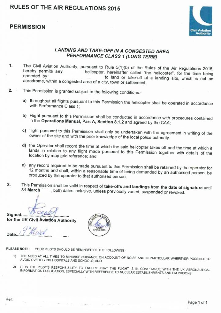
Specific CAA Permissions
Using a landing site, other than an airfield, in a congested area requires specific permission from the CAA. This can be obtained on a case-by-case basis or through a long term permission. Procedures are in CAP 3043.
Similarly, permission is needed from the CAA for landings near organised events of more than 1000 people. Again look at the procedures in CAP 3043.
Future developments
Currently, each operator needs to develop and operate an independent landing site survey procedure, focussed on their operating types and procedures. This is very wasteful of resources, particularly when multiple operators use the same sites (eg UK hospitals or upmarket hotels). In the future, it may be possible for coherent, consistent operating data on helicopter landing sites to be shared between operators in much the same way as airport data is shared (eg via Pooleys). However, given the wide disparity in performance characteristics of helicopter types with respect to obstacle clearance and downwash, this may be a long way off and will need CAA/DfT top down guidance to make it happen. One day!
Conclusion
Accurate surveying of helicopter sites by operators is vital for safe efficient operations of helicopters. It is critical for operators to recognise the level of training needed for surveyors and that the right tools and time are needed to complete the job effectively. A massive catalogue of surveyed sites would be completely impractical for a small operator to keep updated every year, leading to more use of estimated sites, wider use of joint data or contracted surveyors.
Take a look at my others posts. Here are the latest ones.
- Keeping up with the Norwegians – Six amazing innovations for UK HEMS
- LNAV/VNAV (SBAS) – Are they approved for use in the UK?
- Helicopter 2D IFR approaches – Is CDFA the best choice?
- Understanding Helicopter Flight Manuals – Everything you need to operate safely
- Post Maintenance Flight Tests – How to avoid fatal traps
Leave a Reply